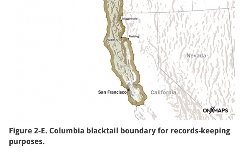
Columbia Blacktail Deer Boundaries for California Beginning in Siskiyou County at the Oregon-California border, the boundary lies between townships R8W and R9W M.D.M., extending south to and along the Klamath River to Hamburg, then south along the road to Scott Bar, continuing south and then east on the unimproved road from Scott Bar to its intersection with the paved road to Mugginsville, then south through Mugginsville to State Highway 3, which is then followed to Douglas City in Trinity County, from which the line runs east on State Highway 299 to I-5. The line follows I-5 south to the area of Anderson, where the Sacramento River moves east of I-5, following the Sacramento River until it joins with the San Joaquin River, which is followed to the south border of Stanislaus County. The line then runs west along this border to the east border of Santa Clara County. The east and south borders of Santa Clara County are then followed to the south border of Santa Cruz County, which is then followed to the edge of Monterey Bay.
Thank you, Bret
